
Vilnius is becoming more and more bike-friendly every year. With new cycling lanes, scenic forest paths, and growing infrastructure, it’s a great time to explore the city on two wheels. But where do you start? In this article, I’ll guide you through the best online tools and platforms to help you plan your route, check current bike path conditions, and ride with confidence — whether you’re a local or just visiting.
Map with Vilnius bike roads
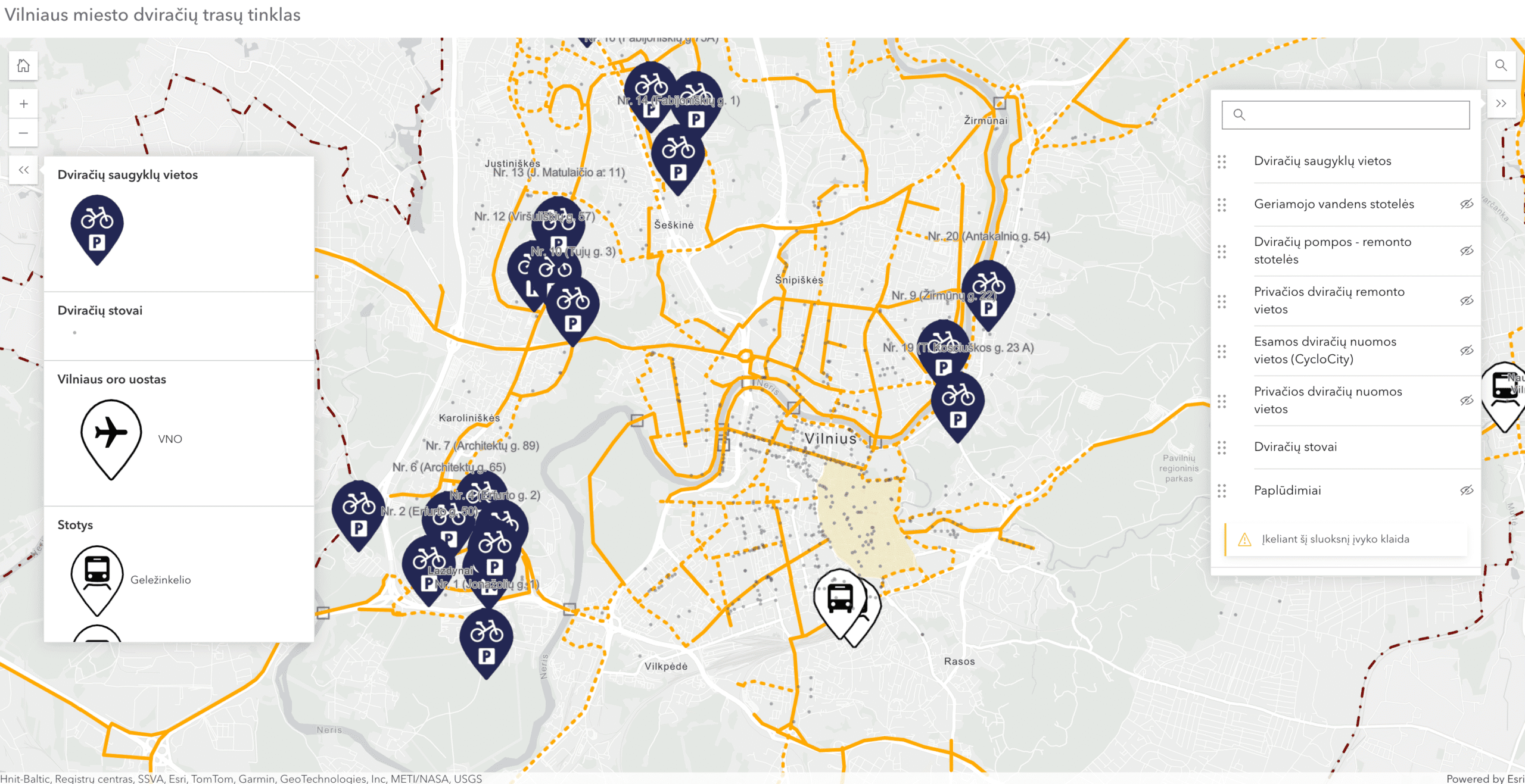
https://sisp.maps.arcgis.com/apps/instant/basic/index.html?appid=142364457e534be5a2163e4b119c720b
Naviki – map + navigation + routes
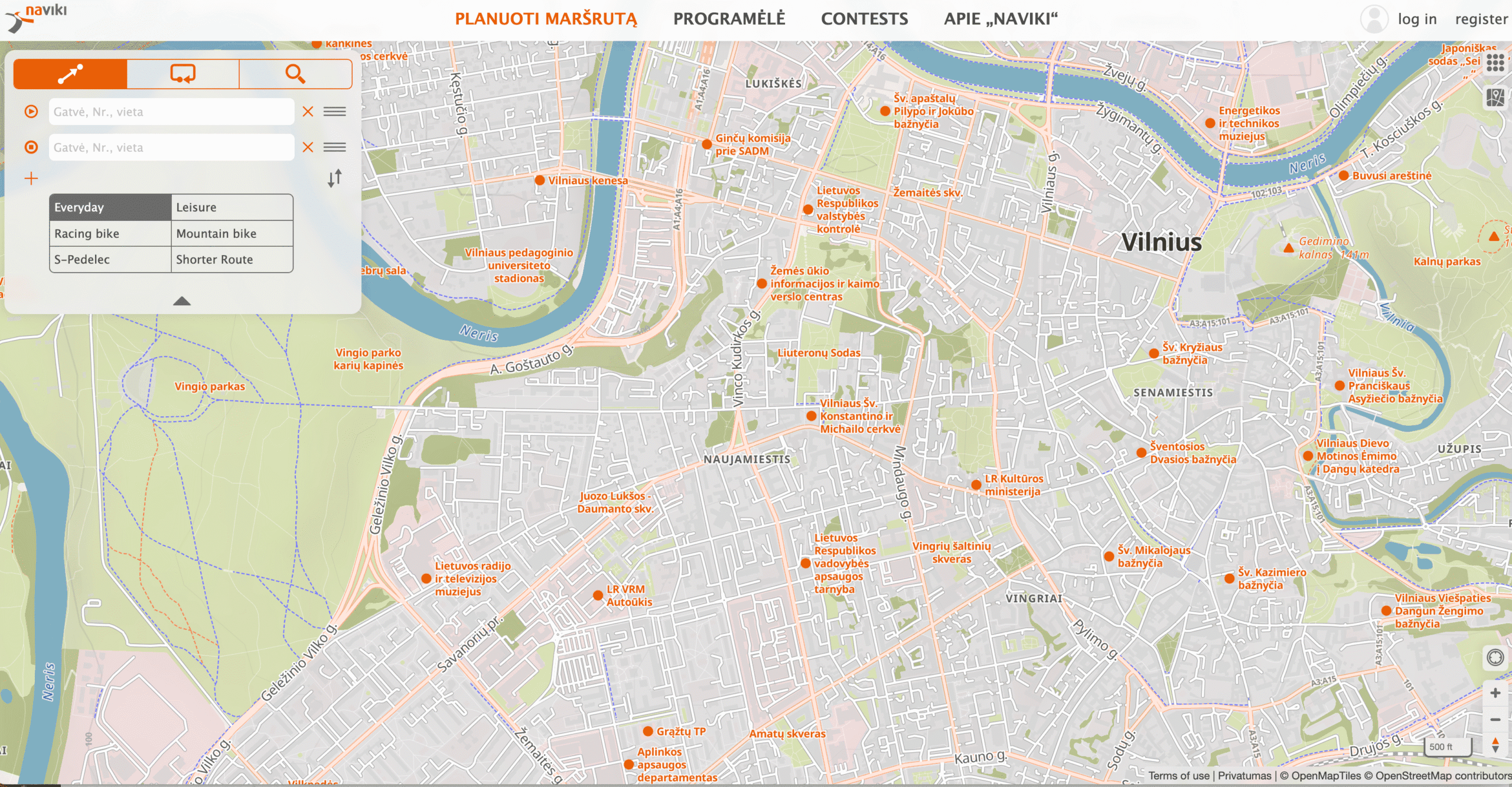
Naviki is a bike-focused route planner designed with everyday riders and commuters in mind. It offers detailed cycling paths across Europe, with options to choose the fastest, most scenic, or safest route. You can also plan round trips or download maps for offline navigation — perfect for exploring without getting lost.
https://www.naviki.org/lt/naviki/planuoti-marsruta/
OpenStreetMaps
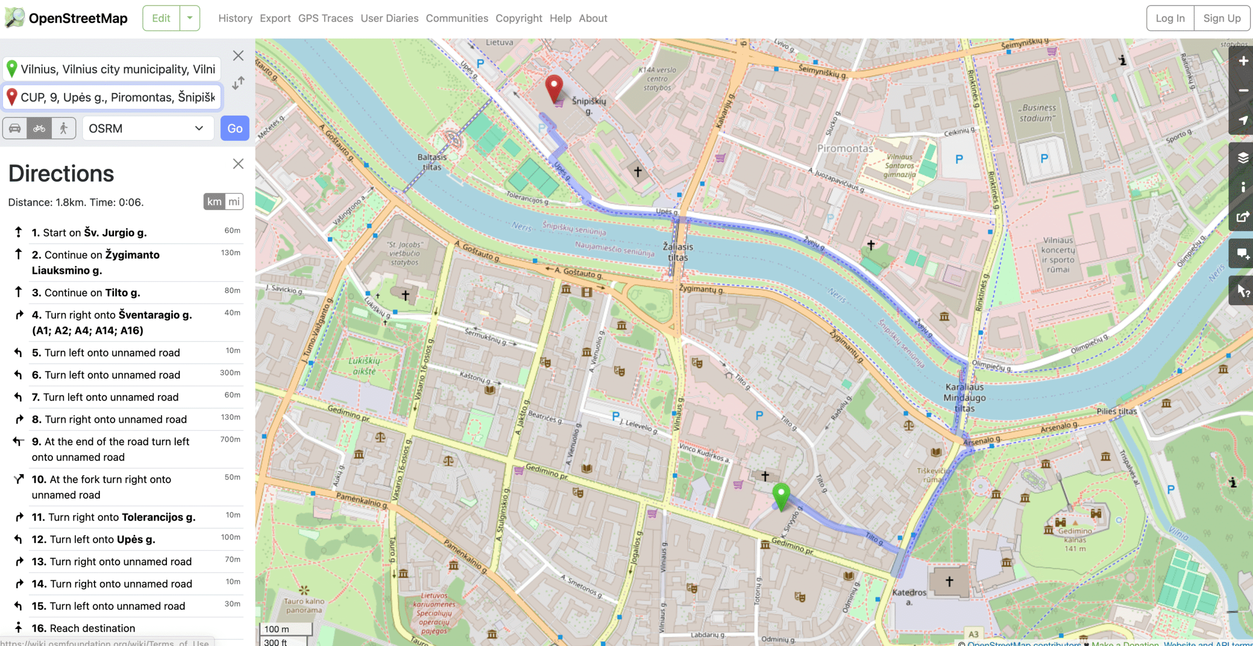
OpenStreetMap (OSM) is a community-powered map that shows an impressive level of detail — including bike paths, cycling infrastructure, and terrain types. It’s especially useful if you want to explore lesser-known routes or check real-time edits contributed by local cyclists. Simple, open, and incredibly versatile.
https://www.openstreetmap.org/directions?engine=fossgis_osrm_bike&ro#map=5/51.522/-0.088
Strava Maps (Routes)
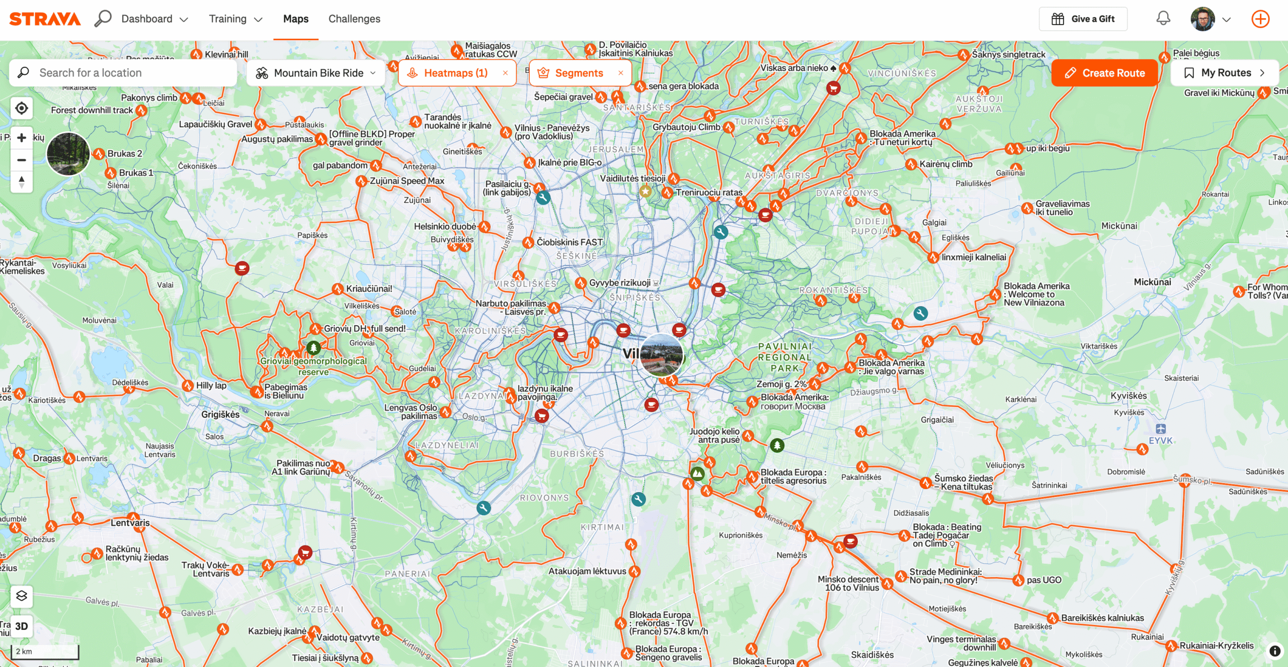
Strava isn’t just for tracking your rides — it’s also a great way to discover popular cycling routes. Thanks to global community data, Strava highlights the most frequently used paths, helping you ride like a local even in a new city. Great for quick route ideas and inspiration on the go.
Follow me onKamoot Maps (Routes)
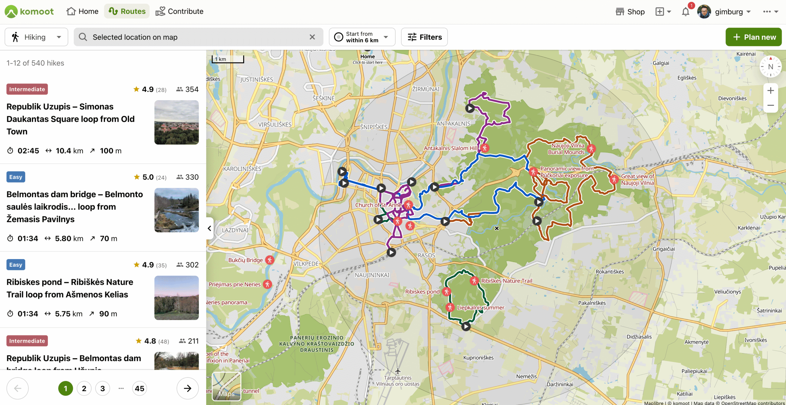
Komoot is ideal for planning detailed, scenic rides — especially if you like gravel paths, nature trails, or long-distance adventures. You can customize your route based on fitness level, surface type, or elevation, and even download maps for offline use. It’s your personal cycling tour planner.
Nakarte.me
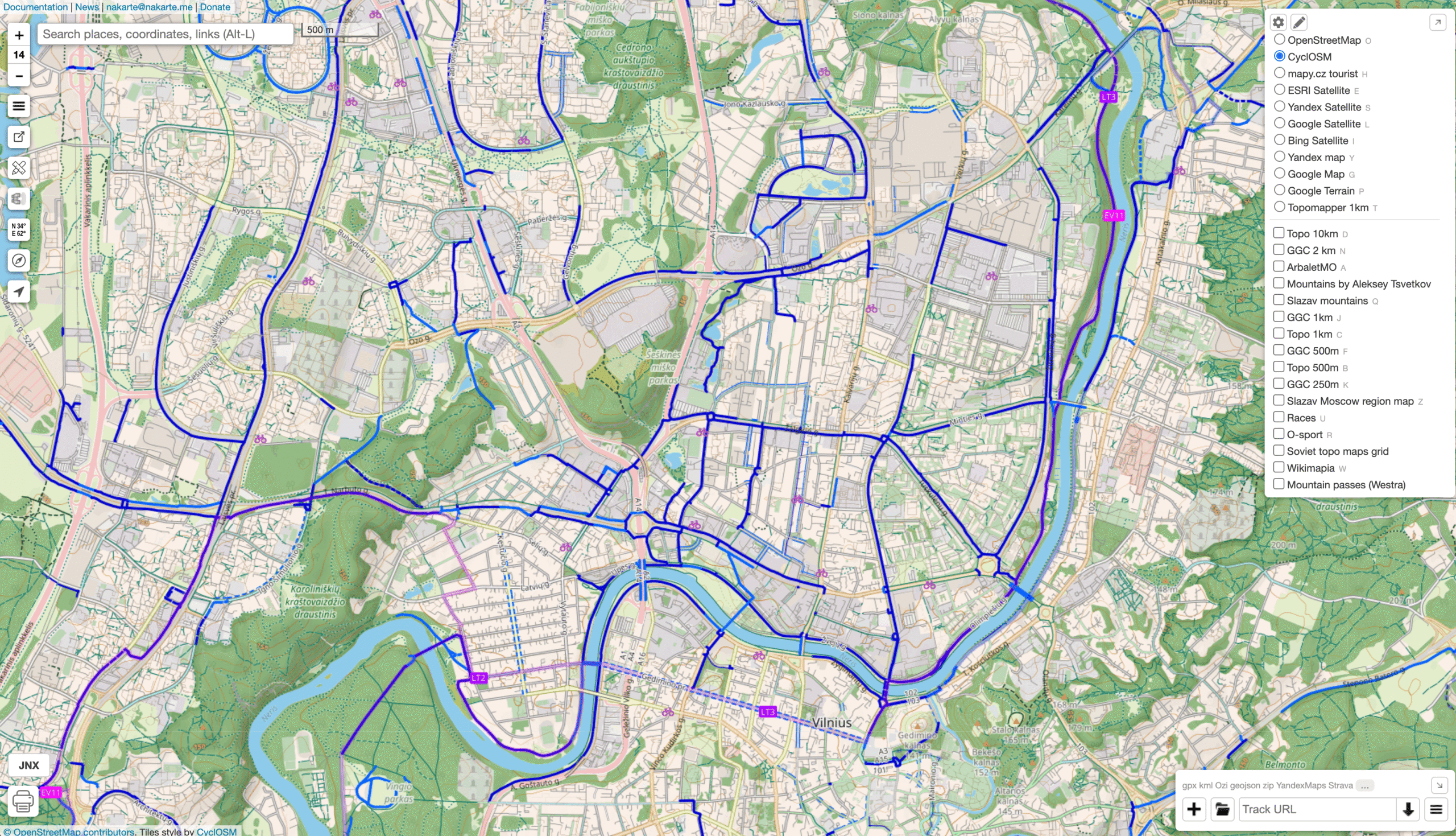
Nakarte.me is a powerful map tool for outdoor enthusiasts, especially cyclists and hikers. What makes it unique is the ability to overlay multiple map sources — from OpenCycleMap to satellite imagery — all in one interface. You can plan detailed routes, measure distances, add waypoints, and even export tracks for GPS devices. Clean, flexible, and ideal for deeper route planning.
https://nakarte.me/#m=14/54.70455/25.27284&l=Co
Discover more from gimburg 🟢 online
Subscribe to get the latest posts sent to your email.